Before we start..
Want to coordinate strategies, share feedback, and stay up to date with the latest Radio Commander: Pacific '41 news? Join our Discord community and connect with other commanders. Find the link here.
Radio Commander '41 gameplay involves commanding in a way similar to that used by commanders during the Pacific War.
It involves issuing orders via radio and receiving reports from units in the field. Based on these reports, the player, as commander, builds a mental picture of the situation and maps it onto the map.
ORDERS AND REPORTS PANELS
The orders panel is located at the bottom left of the screen. The reports panel is located at the bottom right of the screen.
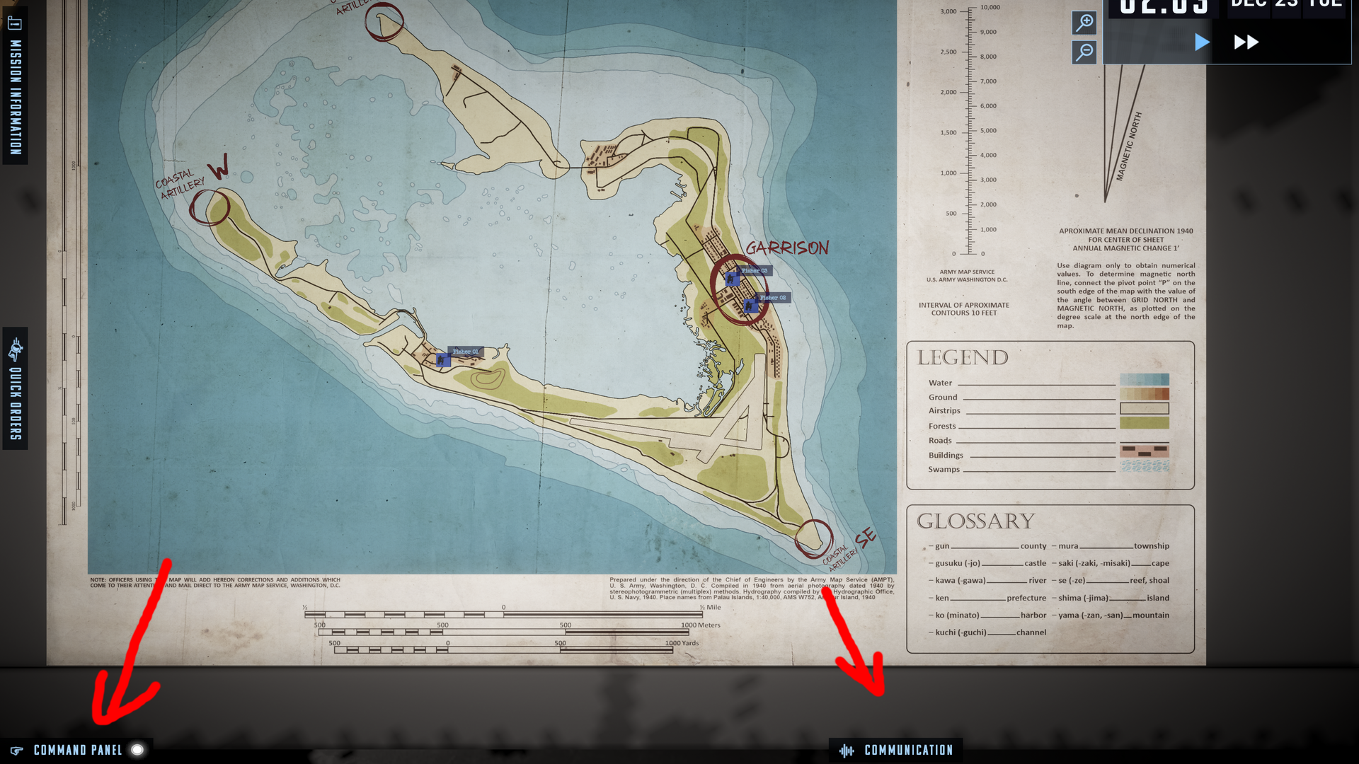
The orders panel is displayed using the SPACE key.
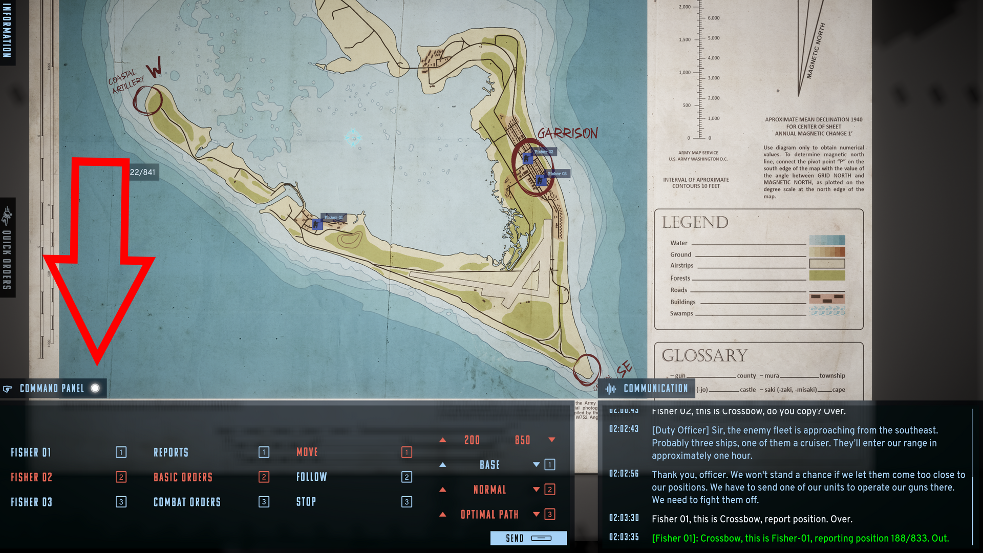
Orders are issued by combining phrases using the keyboard. The order structure involves selecting options according to the WHO-DO-WHAT and sometimes WHERE pattern. i.e., Fisher 01-report-position or Fisher 03-Basic Orders-Move to - Grids....
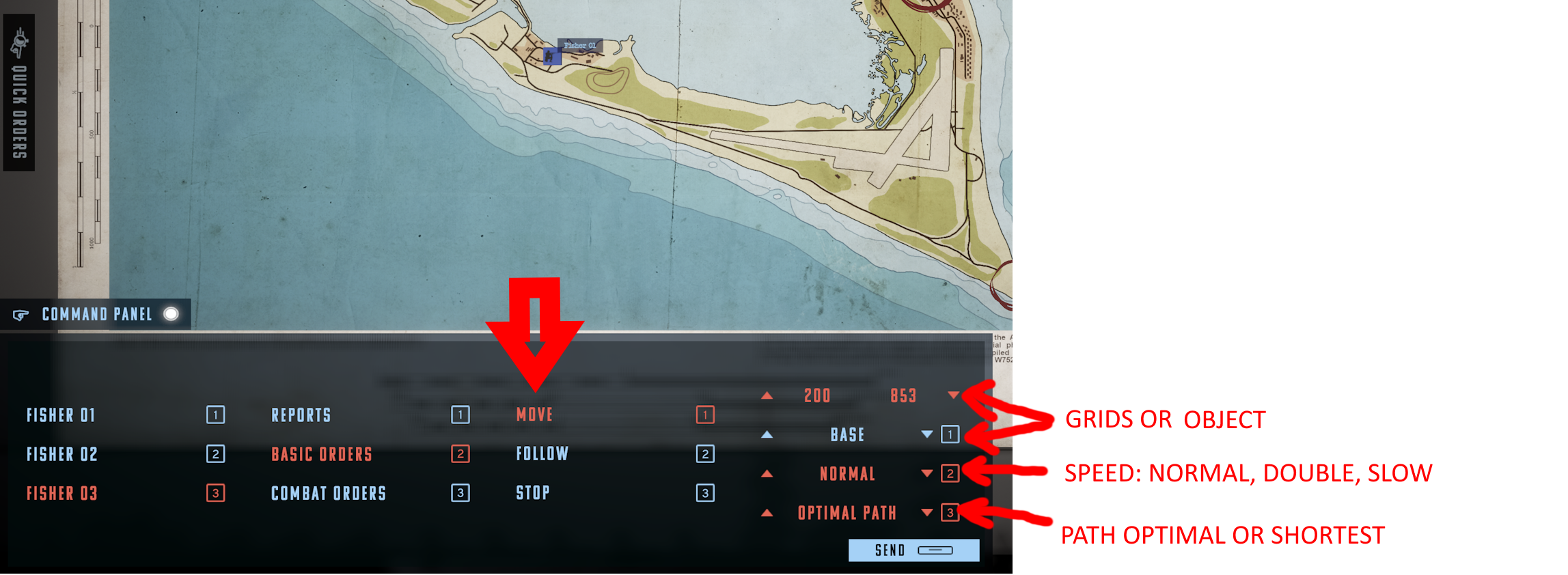
As a commander, you can always request a detailed report on several specific matters.
The commander can call a unit to report:
- position - information in the form of coordinates
- unit status - unit reports: personnel alive/WIA/KIA; morale; fatigue; ammunition/fuel levels; operational activity
- contacts (contacts with the enemy)
- combat status (the unit's combat status)

If you misunderstand the reports or forget update map, you will distort your picture of the situation and make poor decisions.
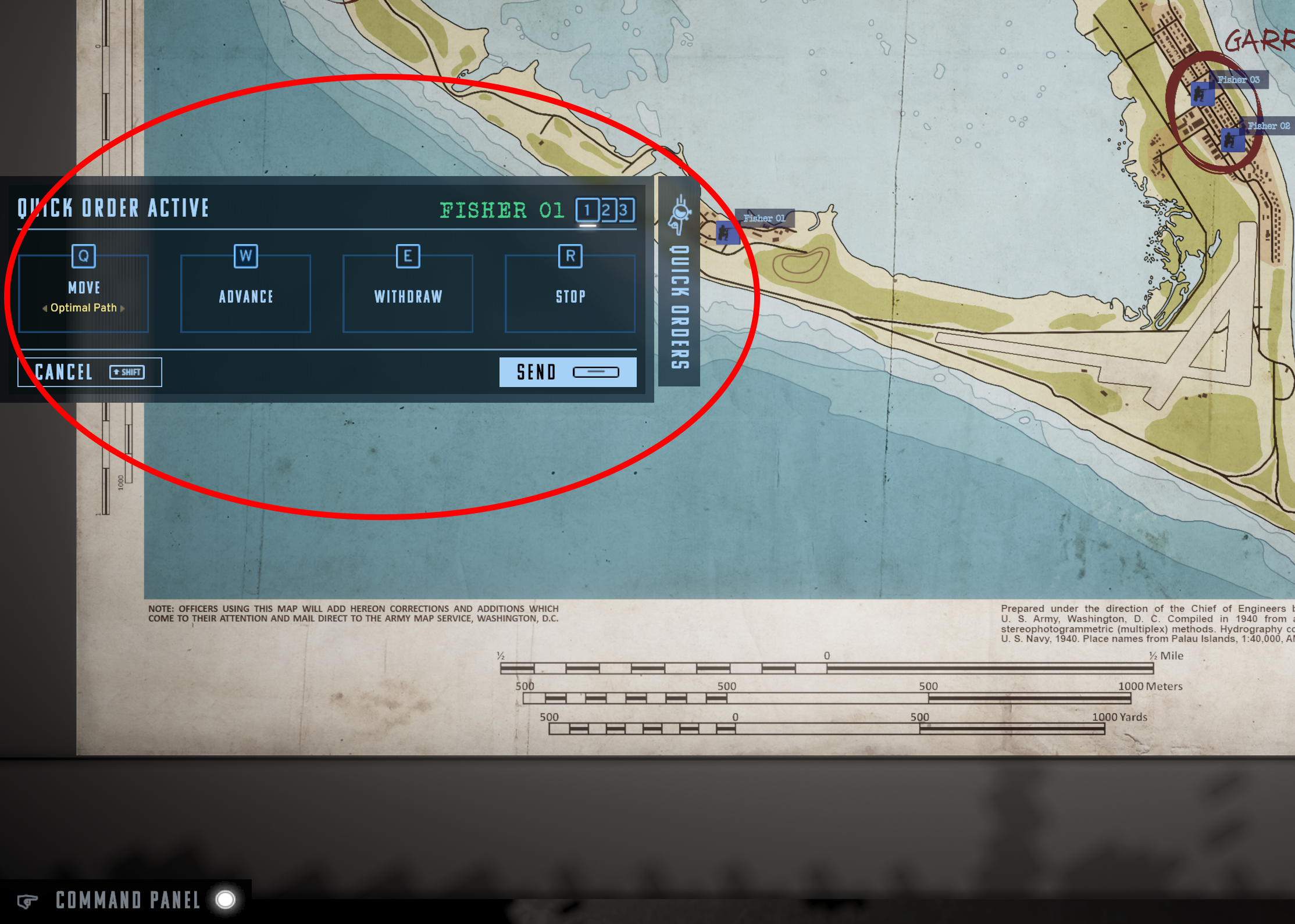
To facilitate issuing orders in dynamic situations, you have the QUICK ORDER panel. It allows you to issue orders faster than the basic panel.
MAP TOOLS
Map tools help commanders orient themselves on the map and draw and write to plan their actions.
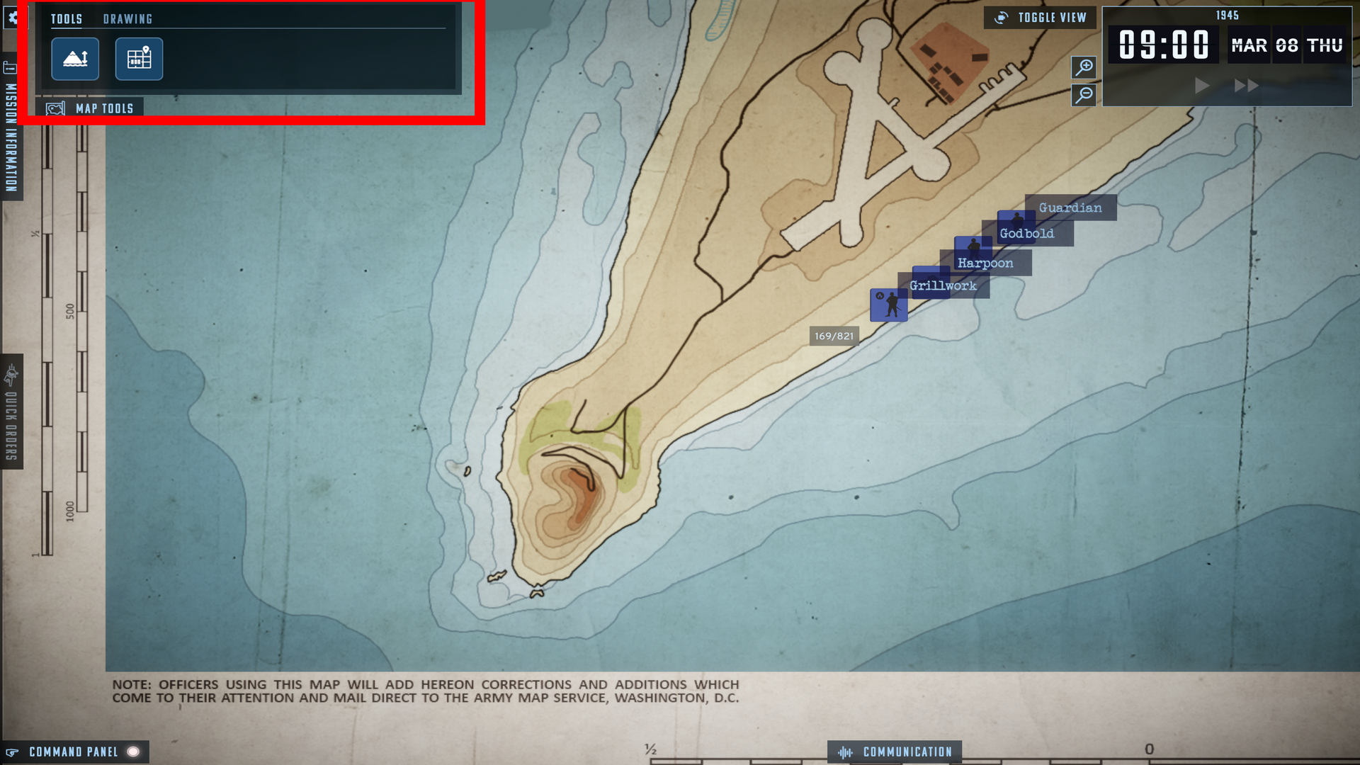
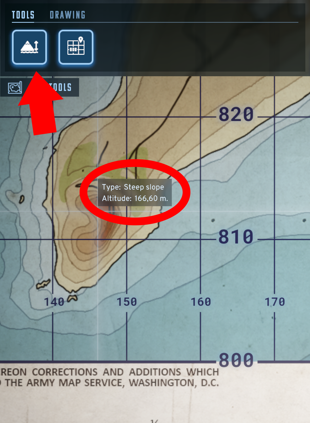
In the TOOLS tab, you can choose to enable elevation, terrain type, and coordinates.
In the DRAWING tab, you can choose line thickness and color. The eraser allows you to erase what you've drawn.
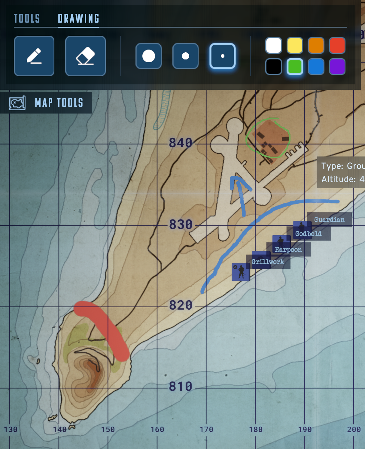
All this so you can visualize the situation in order to complete the mission.
Ruler
This allows you to measure distances. Take a ruler and place it on a spot on the map.
Elevation Measurement
In the MAP TOOLS/TOOLS tab, select the tool for obtaining information about the terrain and its elevation. After turning it on, moving the cursor will display terrain and elevation information.
Displayed coordinate system.
You can use the turn on coordinates lines and numbers to have clear orientation on the map. In the MAP TOOLS/TOOLS tab, select the coordinate system icon. The coordinate grid will appear on the map. Highlighted lines crossing at the cursor location will also help you navigate the map.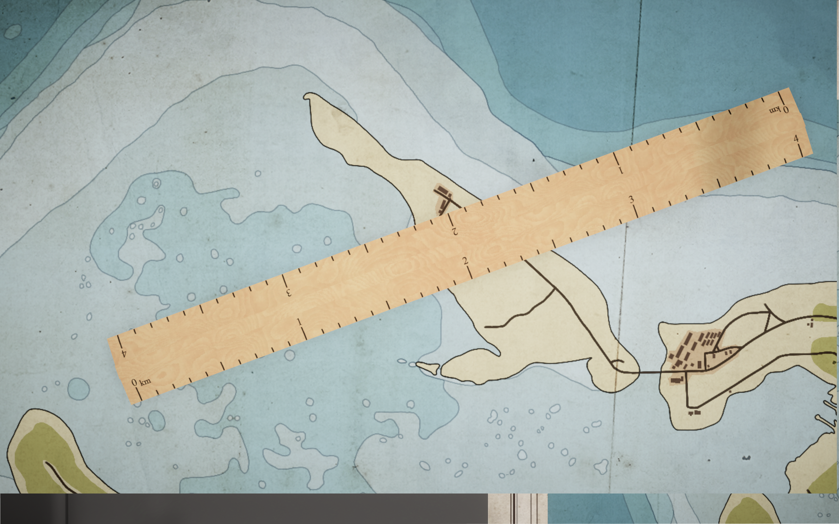
WISHLIST NOW ON STEAM AND SLITHERINE WEBSITE.